
Interplanetary Survival Guide: Martian Map
Your challenge is to create a layered, integrated view of a location or route on the Martian surface that pulls together data from multiple NASA science missions and could help a human explorer plan and carry out a successful Marswalk while conducting new and exciting science along the way.
- 5 resources
- 5 min read
Summary
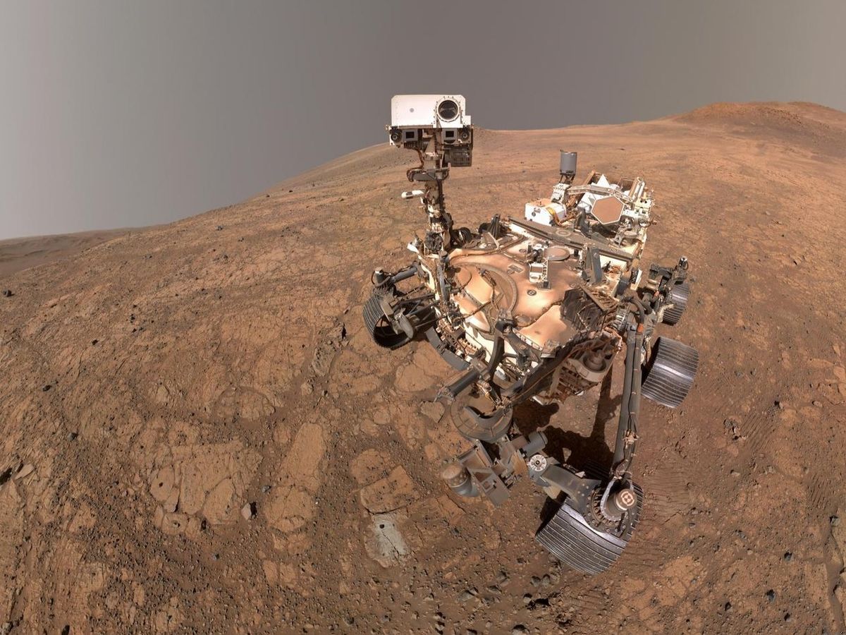
NASA has explored Mars robotically for decades, studying its extreme environment, mapping its surface, and collecting many types of data. Far from home, the first astronauts to set foot on Mars will want the best map possible, with information on the details of their routes and destinations, updates on current conditions, and the data needed to complete their mission quickly and safely. Your challenge is to create a layered, integrated view of a location or route on the Martian surface that pulls together data from multiple NASA science missions and could help a human explorer plan and carry out a successful Marswalk while conducting new and exciting science along the way.
Background
Human explorers are able to conduct science and do other activities that robotic systems cannot. As seen during the recent Artemis II mission’s lunar flyby, astronauts use their critical thinking skills to make connections, solve problems quickly, and apply context to observations and scientific measurements in real time. This is why NASA sends humans into the extreme environments of space, where we can learn more about our solar system and how it formed, and do science we can’t on Earth. Today, human exploration is focused on the lunar surface, with more Artemis missions upcoming and planning for the phased buildup of a Moon Base underway. Part of the role of science missions at NASA is to pave the way for humans to visit new destinations in the future. Each new robotic Mars mission has represented a hugely complex engineering challenge. Sending humans will be the biggest challenge, and the biggest achievement, yet, and becoming an interplanetary species will take all of our knowledge, imagination, and hard work.
Data from NASA’s current and past Mars missions paints a detailed picture of the planet, but it isn’t yet layered together in the combinations needed to plan specific human missions. Tools like the Jet Propulsion Laboratory’s (JPL) Mars Trek and the USGS-NASA Planetary Geologic Mapping Program allow you to layer different data over a global map of Mars, but they are built for regional and global views rather than the hyperlocalized areas astronauts will target on individual spacewalks or surface excursions.
Objectives
Your challenge is to create a map, tool, or interface a Mars astronaut could use during a surface exploration mission, using NASA data and tools. You might start by identifying some scientific goals for your mission and the location the astronaut will explore. For example, if you chose a science objective of learning more about boxwork formations, a geologic phenomenon the Curiosity rover studied in 2025, you would want to pick a location where the formations are abundant, like the Mount Sharp region where Curiosity observed them.
You might start with a location one of NASA’s Mars Rovers or another mission has explored extensively, so you have a lot of data and imagery to work with, or you might challenge yourself by focusing on an area that hasn’t been studied as closely.
You may consider including at least three kinds of data—optical, thermal, spectral, topographic, geophysical, atmospheric, radiation, and chemical are a few examples—layered or combined in a way that provides helpful context for navigating the chosen location.
NASA’s first priority is always astronaut safety, so consider what information might help a crew move safely through a new environment. For example, the radiation environment on Mars differs from those of Earth, Earth-orbit, and the Moon, so you might include space weather data. Astronauts will conduct Mars surface science wearing spacesuits and possibly carrying scientific equipment and other supplies. Consider how this might impact their mobility and, if possible, include a route map that shows where the astronaut will travel to accomplish their scientific objectives while avoiding significant obstacles such as large rock formations.
Potential considerations
You may (but are not required to) consider the following:
- You might visualize your map as a display used inside the crew’s spacecraft or habitat to plan their route, as a tablet application they carry with them, as a heads-up-display (HUD) projected on the spacesuit’s helmet visor, or in another format you imagine.
- Your map can be a static snapshot, an interactive digital product, or a tool or system that generates maps of different locations or with different types of data.
- Look at how NASA missions to destinations other than Mars—Earth, the Moon, other planets in our solar system, and exoplanets in other systems—have created this type of map, for inspiration.
- You may choose to use data from a specific time frame in the past, predicted data and conditions for a future time frame, or no specified time frame at all, for example if you are focusing on more stable information like topography and geology.
- Try looking at imagery taken by NASA’s Mars surface missions to help visualize what it would feel like to execute your mission using your map. Consider how you might include these point-of-view images as part of your map, so the astronaut knows what to expect when they arrive at their destination.
- Think about whether your mission might use rovers or other robotic systems to help transport the crew and their tools, or whether the astronauts might work in pairs to accomplish more science.
NASA does not endorse any non-U.S. Government entity and is not responsible for information contained on non-U.S. Government websites. For non-U.S. Government websites, participants must comply with any data use parameters of that specific website.
NASA data and resources
trek.nasa.gov
Jet Propulsion Laboratory’s (JPL) Mars Trek (opens in a new tab)
NASA web-based portal for exploration of Mars, showcases data collected by NASA at various landing sites.astrogeology-usgs.hub.arcgis.comNon-NASA site
USGS-NASA Planetary Geologic Mapping Program (opens in a new tab)
High-quality standardized geologic map of Marsscience.nasa.gov
Example of a route map visual for the Curiosity example mentioned above (opens in a new tab)
This animation shows a proposed route for NASA's Curiosity rover, which is climbing lower Mount Sharp on Mars. The annotated version of the map labels different regions that scientists working with the rover would like to explore in coming years. A flyover video explains them in more detail.worldview.earthdata.nasa.gov
NASA Worldview (opens in a new tab)
Visually explore the past and the present of this dynamic planet from a satellite's perspective. Select from an array of stories below to learn more about Worldview (a part of NASA Earthdata), the satellite imagery we provide and events occurring around the world.mars.nasa.gov
Mars Perseverance Raw Images Gallery (opens in a new tab)
Over 1 million images captured by the rover on its journey across the Mars surface.
From the NASA Space Apps Challenge. The official page is the final word on this challenge.
Built in Athlone
The 6 projects Athlone teams submitted for this challenge at HackAthlone 2026, from the teams’ own Space Apps pages. Links open in a new tab.
- 2026
- 3rd place in Athlone
Beacon: Live Survival Routing for Every Marswalk
by Team Beacon
Interplanetary Survival Guide: Martian Map
Beacon is a live survival-routing system for astronauts on a Marswalk. Our terrain engine reads real 1 m HiRISE terrain and computes, for every point, radiation exposure, sunlight, and line of sight to base and Earth. It plans walks with science stops, finds natural shelters, and re-plans live as conditions change: rerouting to the lowest-dose cover when a solar storm hits, and using heart rate, exertion, oxygen and water to call the astronaut back before supplies run short. It runs across three linked devices: a command hub in the habitat, a heads-up display built into the helmet visor, and a suit-mounted wrist unit with a map, glove-friendly emergency controls and an alarm. The challenge asks for a hyperlocal, multi-mission map an astronaut can walk with. Beacon layers HiRISE, MOLA, Curiosity RAD, REMS, DONKI and JPL Horizons data at two real sites, Gale and Jezero craters. Our radiation model came within 3% of Curiosity’s measurement at Murray Buttes and is driven by the real May 2024 storm. It matters because Earth is up to 22 light-minutes away, and on 20 May 2024 Curiosity recorded radiation 56 times normal. On Mars, safety decisions can’t wait.
Read moreShow less
Team: Joel Joseph Rajesh, Chetanjot Singh, Ronan Hawkins, Ronn Mathew
- 2026
Azimuth Atlas
by Azimuth Zero
Interplanetary Survival Guide: Martian Map
Using satellite and topography data to plot a map and elevation of the Gale Crater and Curiosity science target locations to calculate the safest and most efficient route to an areas of scientific interest. The UI also displays wind speed, wind direction and ambient radiation to inform the feasibility of astronaut EVAs and surface excursions.
Read moreShow less
Team: Taidhg Trocmé, Tudor-Ștefan Neacșu, Dylan Furlong, Aibhe Lee, Daniel Safarik, Leah Mai Dowling
- 2026
Made For Mars
by BOLL
Interplanetary Survival Guide: Martian Map
Mars is unfamiliar, and an astronaut walking there can only go as far as the oxygen on their back allows. MadeForMars is like Google Maps for Mars: it helps astronauts plan a walk and practise it before they ever step outside. You start on a 3D Mars made from NASA’s own maps and photos, where the app suggests the best places to explore. Zoom into one of five real spots that NASA rovers have visited, choose the places you want to see, and it draws the safest path there and back, avoiding steep ground and making sure you’ll get home before your oxygen runs low. Then you take the walk in a simulation. If something goes wrong, like a solar storm or a leaking suit, it instantly finds the nearest shelter, and afterwards you can replay everything that happened. Before the first person walks on Mars, they should already know the way. Plan your route at made-for-mars.us.
Read moreShow less
Team: Hari Krisshna Bansal, YU XUAN LOW, Yu Hung Leong, Ong Chong Yao
- 2026
Martian Planner and Navigator
by LGTM!
Interplanetary Survival Guide: Martian Map
We aim to meet the needs of the Interplanetary Survival Guide challenge by developing a route planning software alongside a Raspberry Pi based navigator hardware that helps guide users across Mars without the need for GPS, making human based traversal across Mars significantly more feasible.
Read moreShow less
Team: Thomas cotter, Nojus Naravas, Juno Tyrrell, Jazzon Patrick Tiernan, Daniel Ryan, Robert Przystupa
- 2026
Redmark
Interplanetary Survival Guide: Martian Map
RedMark is a layered walk map for astronauts on Mars that also tells them where they are, with no GPS. It answers the Interplanetary Survival Guide: Martian Map challenge for a two-person walk into the Gale crater boxwork on Mount Sharp. Five map layers built from NASA data (terrain and slope, walkability , science targets, conditions on the day , and our own location-quality layer) feed a planner that finds the f astest route that breaks no safety limit. On the way , the crew takes a photo and RedMark matches the skyline against 3D terrain to give a position with an honest uncertainty circle. Mars has no GPS, no compass and a radio delay of up to 24 minutes, so a crew that cannot fix its own position offline cannot walk f ar from the habitat safely . RedMark runs offline and shows where its position is reliable and where it is not.
Read moreShow less
Team: Arsenii Zagriichuk, Maksym Shtymak, Ihor Ivanchenko, Maksym Chechotkin
- 2026
Sharkies
Interplanetary Survival Guide: Martian Map
EVA Sim is an astronaut helmet with a heads-up display projected on the inside of the visor. Built for the Interplanetary Survival Guide: Martian Map challenge, it lets astronauts plan and rehearse a Mars spacewalk at Jezero Crater on real NASA terrain. The display guides the astronaut through each task so they can work efficiently and use as few resources as possible. It also keeps them safe by tracking oxygen, temperature and calorie burn, and keeping those readings in view so they never have to look away from the job. To make the demonstration realistic, we based the physics and the oxygen, temperature and calorie consumption rates on published data and research. We built it with Three.js, React and Electron, so it runs as a desktop app. This matters because on Mars, oxygen and food are limited and help from Earth is minutes away. A helmet that keeps the astronaut informed and on task makes every spacewalk safer and more efficient.
Read moreShow less
Team: Rachel Keaveney, Alexandr, Nandakishore Vinayakrishnan, Aadila Aliu Iyamah, Victor Adebiyi